With potentially inches of rain in the forecast in the near future it may be several weeks or more before any significant new content is added to the site. This time will likely be used implementing new features, so if you have any ideas now is the time to let me know! Email me at sjg@thesjg.com
Victoria’s Secret
After reading on the BHMBA forums that local athlete extraordinare Gary H. and others had marked the Victoria’s Secret loop near Victoria Lake, Sam R. and I decided to head out and see if we could find our way around. It was a pretty good ride (despite beginning with a good climb) and had excellent views. I have already cleaned up the log and recorded quite a few audio notes during the ride, so this should make it onto the website, including details on the (few) tricky spots to navigate fairly shortly.
Log: http://connect.garmin.com/activity/86306860
Mileage (car): 0 (did not drive)
Mileage (bike): 10mi
Website changes and a new blog
Yesterday and today I have been working on a number of non-functional website changes, these include some static content such as the About page for interested parties as well as the Legal and Advertising pages. Also new is this blog, which is intended to bring interested parties both a better understanding of the what, why and how this site operates as well as relevant trail news and happenings from around the Black Hills.
This blog is brand new as of today, but I have already back-dated a couple of posts and may back-date more in the future in order to provide some semblance of linearity
Trail 40L recon.
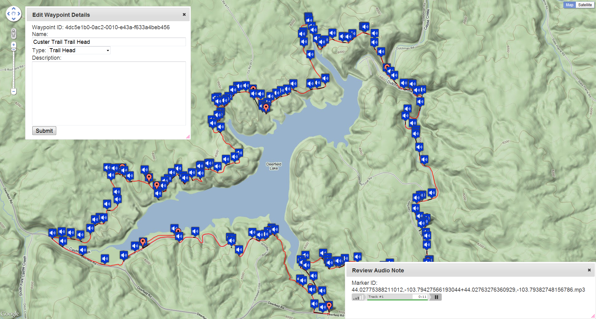
Made my way out to Deerfield Lake today to ride the Deerfield Lake Loop, also known as Trail 40L. Based on the Forest Service literature I expected to do the loop twice in about 4 hours, once clockwise and once counter-clockwise. The Forest Service put the distance at 10 miles and calls the terrain moderate, in reality the route is more like 12 miles and conservatively 1800+ feet of elevation gain. I ended up doing one slow loop clockwise that clocked in around 3:20, and this seemed like a good direction choice, while there are very steep sections in both directions the clockwise direction means you get to make up a lot of your elevation gain on double track with a relatively easy grade.
This was the first ride I have done annotating my progress with a digital audio recorder attached to the shoulder strap of my CamelBak, post-ride I rejiggered the website backend to show all of these audio annotations as a map overlay. This way I can reference my audio notes while writing track and waypoint descriptions, all in all this is working quite splendidly so far.
Log: http://connect.garmin.com/activity/83896760
Mileage (car): 100
Mileage (bike): 14
New gear: OLYMPUS VN-8100PC USB PC Interface Digital Voice Recorder ($60)
New Jeramy trail at Buzzards Roost
On the first Monday in May I decided to map the new trail at the Buzzards Roost Trail Network that was recently completed by the BHMBA to satisfy a standing grant. Riding with a broken hand I managed to get a good log and after conferring with Dan S. put the new trail up on PahaSapaTrails.com with a description with the name Jeramy.
Log: http://connect.garmin.com/activity/83098488
Mileage (car): 25
Mileage (bike): 5.65